The Río Frío and Río Sevilla basins in the Magdalena region of Colombia increasingly face challenges in terms of both water quantity and quality between different water users. As in many areas of Colombia, the agricultural sector makes up most of the water demand. However, water use inefficiencies, uncertainty in water availability and in water usage hamper the huge potential for agricultural production in the basins, the sustainability of such production and the conservation of the ecosystems involved. To address these issues, the Dutch Ministry of Agriculture, Nature and Food Quality (LNV) commissioned Resilience BV and Acacia Water to conduct a baseline study on water use, availability and governance in the watersheds, followed by the development of a Decision Support System (DSS) which will give insights in the state of water resources within the basins, on the basis of which a more inclusive and constructive water management dialogue can be held among all user groups.
Beeld: © LAN Bogota
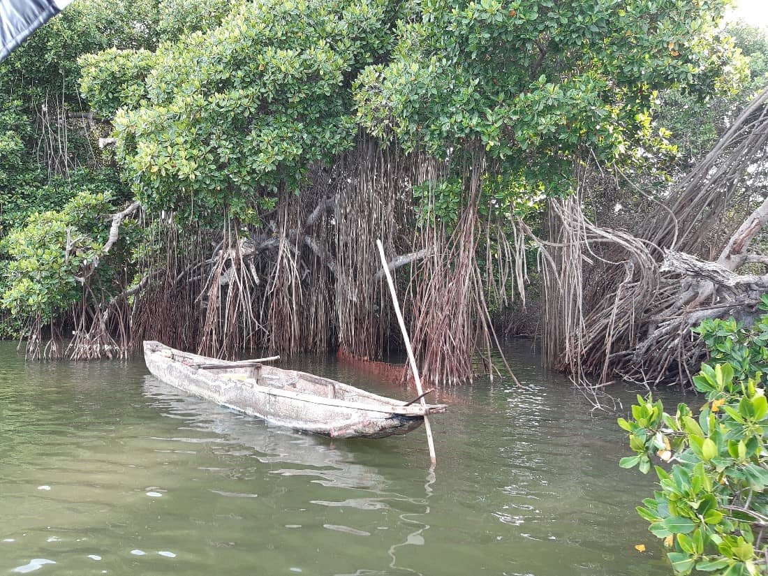
Ciénaga Grande de Santa Marta - Ramsar Site
Contested resources
The Río Frío and Río Sevilla originate on the western flank of the Sierra Nevada de Santa Marta, a UNESCO-declared Biosphere reserve. Downstream, the rivers join and flow into the Ciénaga Grande de Santa Marta, a Ramsar wetland. The Río Frío and Río Sevilla provide fresh water for the livelihood of the approximately 185,000 inhabitants of the surrounding municipalities. The middle and lower section of the river basins host the production of commercial crops such as banana and oil palm, while coffee is grown in the middle-higher section. The sustainability of these production systems is threatened by water shortages and inefficient irrigation practices, alternating availability of water (shortage during dry seasons vs frequent flooding in the wet seasons) due to climate change, and other environmental problems such as salt intrusion and soil erosion. Lower river discharges in the dry season also mean that access to water is restricted. The unpredictability of water supply poses difficulties in farm planning and decreases the efficiency of operations. However, not only agricultural producers suffer from these issues. Rural populations are also affected, as the rationing of water during the dry season also applies to water destined to domestic use. Last but not least, ecosystems, biodiversity and other production systems are threatened. An extensive exploitation of river basins can lead to an increase of brackish water levels in the Ciénaga Grande de Santa Marta, with repercussions, amongst others, on the fish (and fishermen’s livelihoods) and mangroves populations.
Beeld: © LAN Bogota
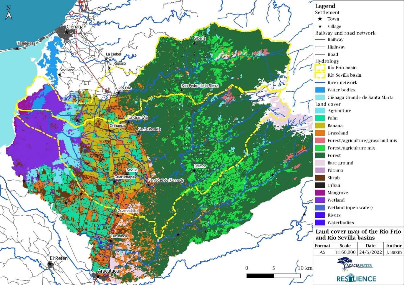
Landcover map of the Rio Frio and Rio Sevilla basin
Building on previous RVO’s Partners for Water-funded initiatives that aimed to improve water efficiency in the banana and oil palm sectors in the Magdalena region, this project aimed to improve water allocation amongst all users, by adjusting governance practices and developing a DSS in collaboration with key stakeholders from both the water management and users’ side. To support the development of the DSS, stakeholder assessment of the Río Frío and Río Sevilla basins was conducted, combined with a baseline assessment based on literature review and data collection to assess the status of identified water sources, water availability, water demand and water quality for the Frío and Sevilla River Basins.
Current state of the basins
Within the basins, many stakeholders from different societal groups play a role in the governance of natural resources. With regard to water management, most of them are brought together within the Plataforma de Custodia del Agua (PCA), a multistakeholder platform initiated by WWF Colombia and Good Stuff International (GSI). CORPAMAG is the regional environmental authority which grants long-term water use permits in the area, while two irrigation associations (ASOSEVILLA and ASORIOFRIO) allocate the water from both rivers to the different users.
Beeld: © LAN Bogota
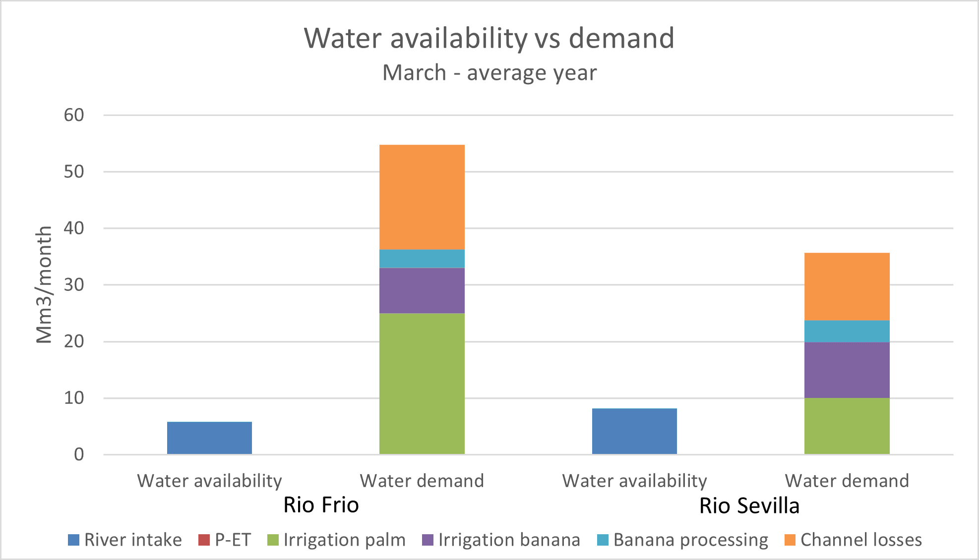
Example of water availability and demand/use in March of a given year
The baseline assessment, which can be downloaded below, concluded that during the dry season, competition among different water users is fierce and water demand far exceeds water availability. Even when not taking into account environmental flow requirements, water availability is not sufficient for all the producers during the dry season, leading to a decline in agricultural productivity. Other issues are the declining availability and quality of water for human consumption, the increasing salinization of groundwater and soils, increased sedimentation, and increasing incidence of floods.
Effective water governance is sometimes affected by incoherent policies and contradicting jurisdictions. Data availability, accessibility, monitoring and transparency regarding water use and availability are further challenges that limit trust and engagement in the basins. Likewise, users acknowledge the need of timely, intelligible and user-friendly information that supports decision making processes. Another key issue is the underrepresentation of several groups and water users, most prominently the Ciénaga Grande and the communities depending on this ecosystem. Finally, water allocation priorities are unclear and environmental flow is often not met.
Towards improved water governance: providing data insights
In response to these challenges, as a result of this project, a Decision Support System was developed based on the findings of the baseline study and the governance assessment. This DSS was developed according to a user-centered design approach, in which use cases and needs are defined together with the intended users. Through this approach, several user groups with different use cases were defined: agricultural producers looking for insights into water availability for better planning of irrigation practices; irrigation associations that want to have better insights into water use within their service area; government institutions responsible for long-term water planning that are looking for a general overview of water availability and use within the basins. Based on these use cases and user requirements (user friendliness, accessibility, filtering, language, etc) several pilot versions of the DSS were developed and tested in close consultation with the PCA through an iterative process. This has ultimately led to a final version of the DSS, which consists of a PowerBi-based online dashboard, fed by user data through Open Data Kit (ODK) questionnaires and by open-source data on water availability and meteorological conditions from multiple sources. The DSS contains, other than the homepage, the following pages:
- A general overview page of the basins with locations of producers, water measurement stations, river discharges, and a summary of the data available in other pages, plus a button for an information pop-up
- Water availability: overview of river discharges and precipitation data for multiple sites;
- Water use: overview of producers’ information such as water use, crops, irrigation systems, and their locations;
- Weather forecasts with temperatures and precipitation amounts for multiple sites.
Together with the dashboard, user manuals for different user groups were formulated, including a description on how to enter data using the ODK questionnaires. The tool is handed over to the PCA’s technical secretariat (WWF and GSI) which can continue the process by incorporating the recommendations as outlined in a strategic advice report delivered with the tool. This report recommends to further improve data collection and linkages to existing databases to feed into the DSS dashboard, as well as incorporating it in a more extensive basin monitoring tool (which also includes the state of other aspects of the natural environment) currently under development by the PCA.
By design, the DSS is directed to different user categories (agricultural producers, irrigation associations, government institutions), each of which will benefit from a clearer picture of all water-related affairs in the region. The continued and proper use of the DSS tool will allow to collect, analyze and streamline information on the water demand and availability in the two river basins. Thanks to this, it will be easier to kickstart target interventions and monitor their effects, with the ultimate goal of managing water resources in the region for the wellbeing of all: people, agricultural productions and ecosystems.
Beeld: © LAN Bogota