In the summer of 2021, Nectaerra and Wageningen University carried out a scoping study to provide an overview of the water and salinity situation in southern and central Iraq. The Mesopotamian Basin increasingly faces water shortages and soil degradation, for which the attached report lists some potential coping mechanisms.
The Mesopotamian basin in Iraq is one of the cradles of agriculture; remainders of over 7000 year old agricultural tools were found, as well as written texts of 3000 years old with instructions on sowing and irrigating. The bulk of the water for the Mesopotamian basin agriculture systems comes from the Euphrates and Tigris rivers and its tributaries. Around 70% of this agriculture is irrigated, either through gravity irrigation or pumping from rivers and aquifers.
Over the last decades, the volumes of water that are used are rising while the available water volumes are decreasing. Droughts, poor water management, population growth, climate change, and reduced inflow of transboundary rivers are the main reasons.
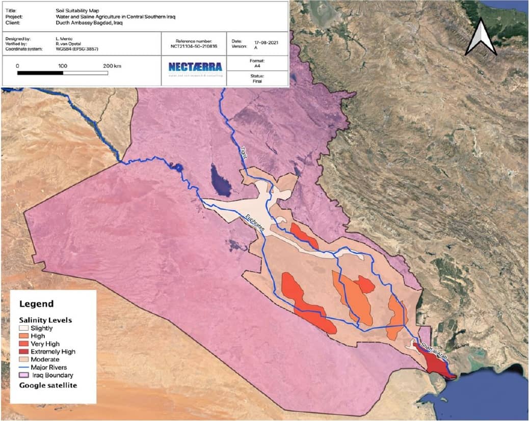
Already in the old days, the Mesopotamian basin faced salinity challenges; there are records of serious crop losses of thousands of years ago. And today, this is still the case. Both natural and man-made processes cause salinity, such as dissolving salts from marine deposits, high evaporation rates, poor drainage in irrigation schemes, and intrusion of salt water.
The report presents maps of water quality which roughly indicate the areas in the Basin where water is suitable for agricultural purposes. Maps on saline soils are available, however, the salt concentration in the topsoil (plant roots) is not easily detected by remote sensing and salt tolerant crop vegetation can result in mis-interpretation of findings. The near-real time FAO WaPOR map can assist policy makers and farmers in water productivity monitoring.
Furthermore, the report lists a number of solutions to prevent or cope with water shortages and salinization in order to develop the agricultural sector in the Mesopotamian basin. These range from on-farm measures such as use of salt tolerant varieties, tillage and soil improvement practices, and drainage to landscape measures such as inclusion of trees. And from policy level steps on water use institutions to improved monitoring as basis for planning. The farmers’ commercial aspects and preferences should be starting point. The authors hence put forward the design of agro-hubs, where farmers can experiment and the enabling environment is facilitated.